EO4all
Module for urban planning
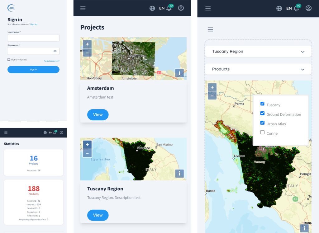
- Design dedicated web app (accessible also from mobile platforms) to allow users to access elaborated Earth Observation (EO) data and understand the added value of Copernicus data also when used in integration with other sources
- Implemented activities will rely on both existing programme (Services Usage) and dedicated processing (Algorithm Implementation)
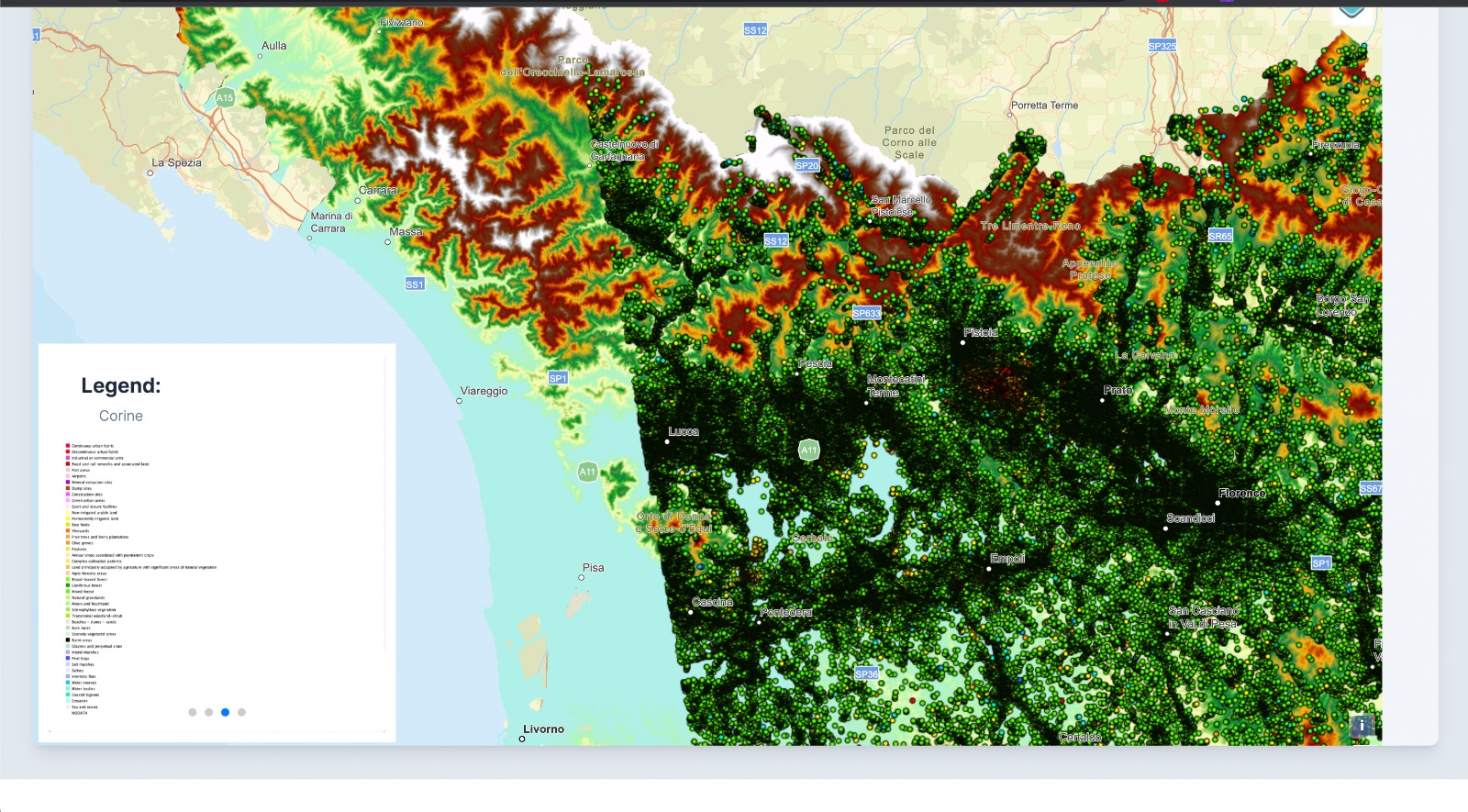
- Corine Land Cover
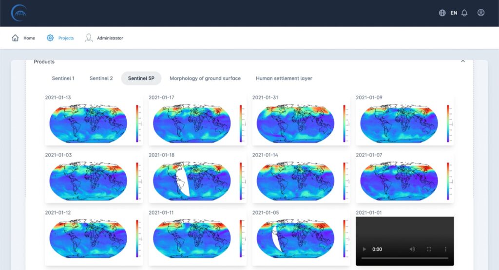
- Sentinel 5p pre processed (SO2, NO2, O3, CO)
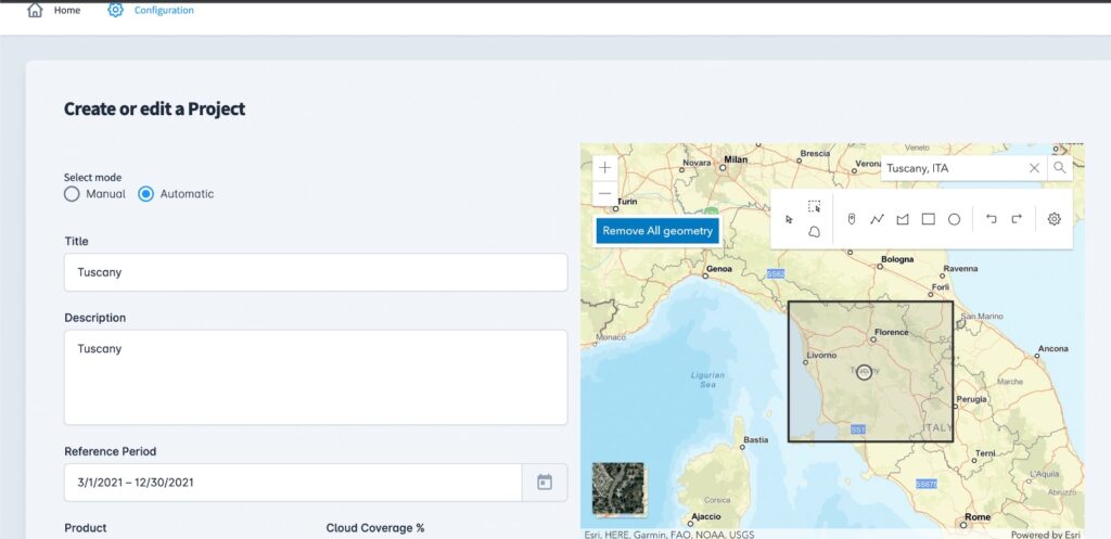
o Creation of mobile app dedicated to urban planning and monitoring (also for rural areas) based on Copernicus Sentinel I, II and 5p EO data integrated by external additional information services. The spatial resolution of Copernicus data: up to 10 meters.
o Possibility for the user to select an area and obtain Sentinel I, Sentinel II, Sentinel 5p, products in minutes
o Several ingested data (Sentinel I, Sentinel II, Sentinel 5p, human settlement (corine, worldpop, atlas)
o Implemented a use case in Tuscany region area based case (Sentinel I, Sentinel II, Sentinel 5p, human settlement (corine, worldpop, atlas) where also ground deformation processing has been included.